Introduction
The Brookline Precinct Profiles, otherwise known as, “Where in the World is Your Precinct?” were conceived by the Brookline Town Meeting Members Association (TMMA). The profiles have been developed for two purposes: First, to ensure that precinct residents have a resource to refer to when seeking information about their precinct; Second, for Town residents in other precincts and other people interested in learning more about a particular precinct.
Precinct 5 Narrative
Precinct Boundary
Precinct 5 is located in north east Brookline, adjacent to Brookline precincts 4, 6, and 14. It is bounded on the north by Boylston and Allerton Streets; on the east by High Street and the City of Boston; on the south by the City of Boston and Chestnut and Walnut Streets; and on the west by Warren Street.
Precinct 5 History
Precinct 5 is bordered by the old Worcester Turnpike (1806), the Emerald Necklace, and Chestnut and Warren Streets. It includes most of the Pill Hill area, the Point, and a section of the Town Green neighborhood.
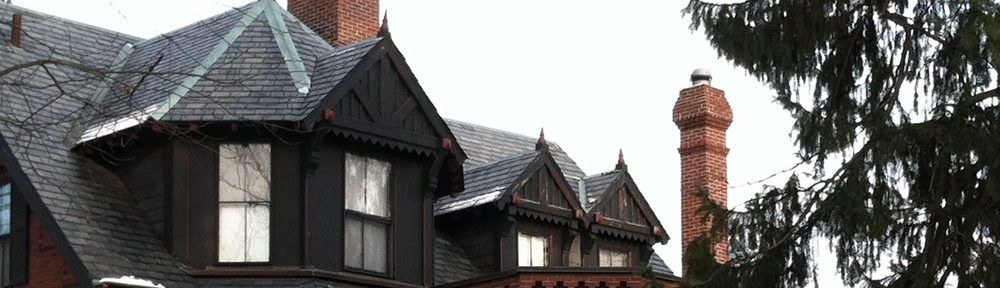
Walnut Street, known as the old Sherburne Road laid out in 1658, was the central link from Boston through Brookline and out to points west. By the mid 19th century, the shift of the civic center from Town Green to Brookline Village and the coming of the railroad led to a spurt in development and the annexation of the area from High Street to the Muddy River. Pill Hill is a wonderful mix of 19th and 20th century styles ranging from Federal to Italianate and Mansard to Queen Anne to Colonial Revival. The residents of the neighborhood carefully developed much of this section. The Tappan-Philbrick house, built in 1805, was a center of Brookline abolitionism and a stop on the Underground Railroad. The Swedenborgian Church, now the Latvian Lutheran Church, was constructed in 1862 by members. The Brookline Land Company formed in 1860, planned and sold off land until the early 20th century. The area known as the point became a center for the Towns immigrants and workers of the 19th century with Irish, Germans and Italians. This is a rare area with wonderful triple-deckers and single-family houses. The houses on Hart Street are some of the earliest in the Town, having been built in the 1840s and moved here from Brington Road in the 1870s. The Town Green area across Cypress Street encompasses the area that was the geographical center and the first civic center. The Lincoln School complex was built in the 1980s. The Kennard House, now the Brookline Music School, is an outstanding example of the Regency style, designed by Gridley Bryant.
Precinct 5 Today
Consisting of 169 acres on 7,355,943 square feet of land area, Precinct 5 is typified by one, two, and three-family homes on small to moderate sized lots. However the precinct does contain a moderate amount of multi-family residential. Renter-occupants and owneroccupants are nearly equal in number. There are 191 affordable housing units currently in Precinct 5. Finally, Precinct 5 contains a small amount of retail, office, and other commercial uses on Boylston Street.
As noted, the predominant land-use pattern in Precinct 5 is single, two, and three-family residential which makes up nearly 94 percent of the zoned land and more than 56 percent of the land area of the precinct. Precinct 5 does not have a clearly defined focal point but the intersection of Boylston and Cypress Streets could be such an area. Precinct 5 contains nearly 23 acres of public recreation and open space including Harry Downes Field; the Old Lincoln, New Lincoln, Margaret Robinson, Clark, and Sewall playgrounds; the 100 Walnut Place and Walnut Street conservation land parcels; Olmsted Park; and Philbrick Square. Major public facilities in Precinct 5 include the Old and New Lincoln Schools. Houses of worship in or near the precinct include the First Parish Church and the Latvian Lutheran Exile Church.