
 1855 1855
|
1884
|
![Plate G (right half) from Atlas of the Town of Brookline, Norfolk County, Massachusetts. 1874. (Brookline Public Library: [Brookline Room] 917.445 B76 1874) Streets on map: Boylston Street, Walnut Street.](wp-content/uploads/2013/11/atlas1874_plateg.jpg)
click image for larger view or download higher resolution pdf
Plate G (right half) from Atlas of the Town of Brookline,
Norfolk County, Massachusetts. 1874.
(Brookline Public Library: [Brookline Room] 917.445 B76 1874)
Streets on map: Boylston Street, Walnut Street.
click image for larger view or download higher resolution pdf
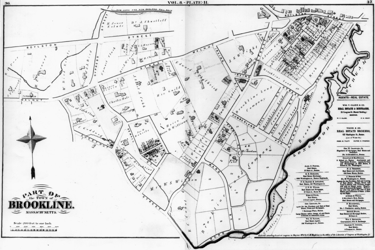
Plate H
Streets on map: Cumberland Avenue, High Street, Glen Street, Hill (Hawthorn) Street,
Irving (Allerton) Street, Pond Avenue, Sewall (Cypress) Street, Summit (Edgehill) Street,
Walnut Place, Walnut Street, Ward (Highland) Street.
|
1855
|
1884
|